Station Plaza St Marys

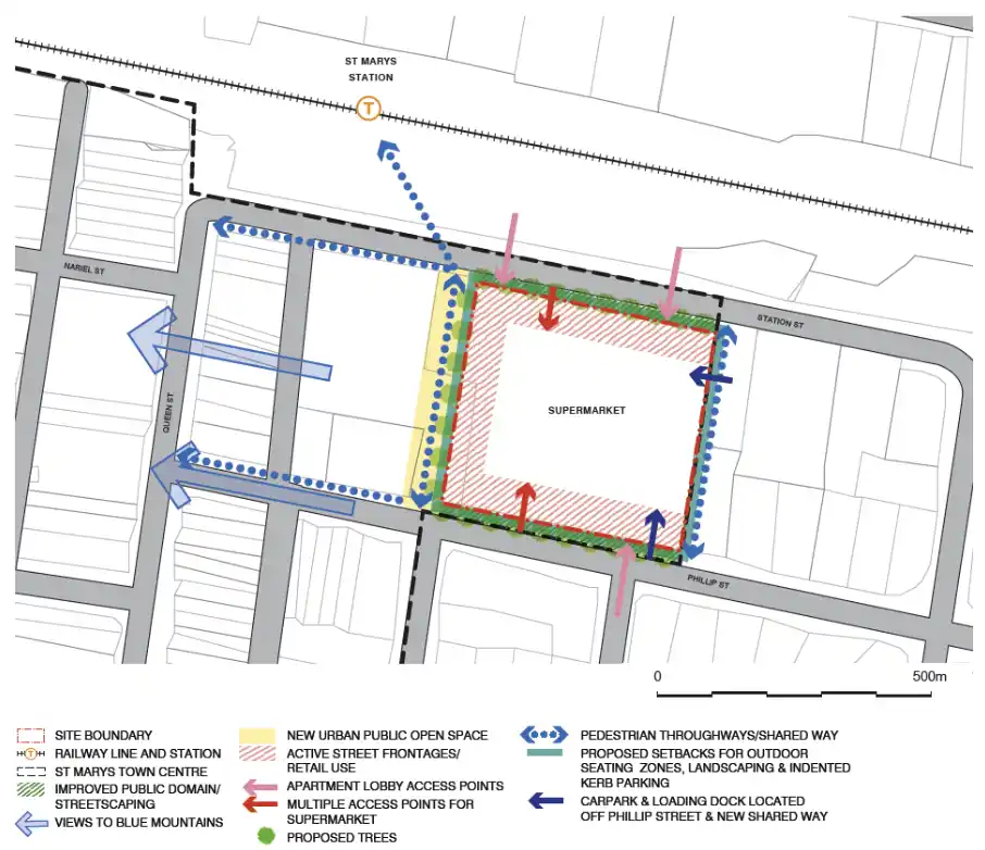
Ason Group was engaged by Haben Property Fund to prepare a Traffic Impact Assessment to support a Planning Proposal for a mixed-use development at 33-43 Phillip Street, St Marys. Further to a proposed amendment to existing FSR provisions, the Site provides an indicative yield of:

  • 584 residential units.
  • 2,200m² GFA of office floorspace.
  • 1,165m² GFA of retail floorspace.

The preparation of numerous preliminary assessments examining the proposal in the broader context of the St Marys Town Centre

Our work included

  • Significant consultation with Penrith City Council and Roads & Maritime Services in regard to the scope of the assessment, particularly given planning broader proposed zoning and land use changes in the Town Centre in line with State Government planning policies.
  • Detailed SIDRA modelling of existing and future traffic conditions.
  • Intersection upgrade recommendations.

Similar Projects

Ason Group was commissioned to assess the development of an Industrial Estate in Manchester Road, Auburn. The site had been the subject of a number of mixed-use, residential and industrial proposals over a number of years, but none had progressed through to a Development Application. Further to a detailed iterative

View Details

Auburn Industrial Estate

At 240 hectares, ESR’s Moorebank Intermodal Precinct is Australia’s largest intermodal facility. Conveniently located on Moorebank Avenue 1 kilometre south of the M5 Motorway interchange, the facility is ideally situated for the distribution of goods both regionally and nationally via the road and rail networks. Due to its favourable location

View Details

Moorebank Intermodal Precint

The Mamre Road Precinct (MRP) forms part of the Western Sydney Employment Area (WSEA) and Aerotropolis was rezoned in June 2020 to permit industrial land uses across approximately 850 hectares of land and over 3.5 million square metres. Ason Group was engaged to work with key stakeholders including Transport for

View Details

Mamre Road Precinct – Road Network Assessment