Edmondson Park Town Centre

Ason Group has been involved with further design development of the Edmondson Park Town Centre to support the lodgement of a Section 75W application to the Planning Assessment Commission (PAC). 

The development of the town centre would provide for approximately 3,500 dwellings and 40,000m2 of commercial floor space to the immediate south of Edmondson Park Railway Station.

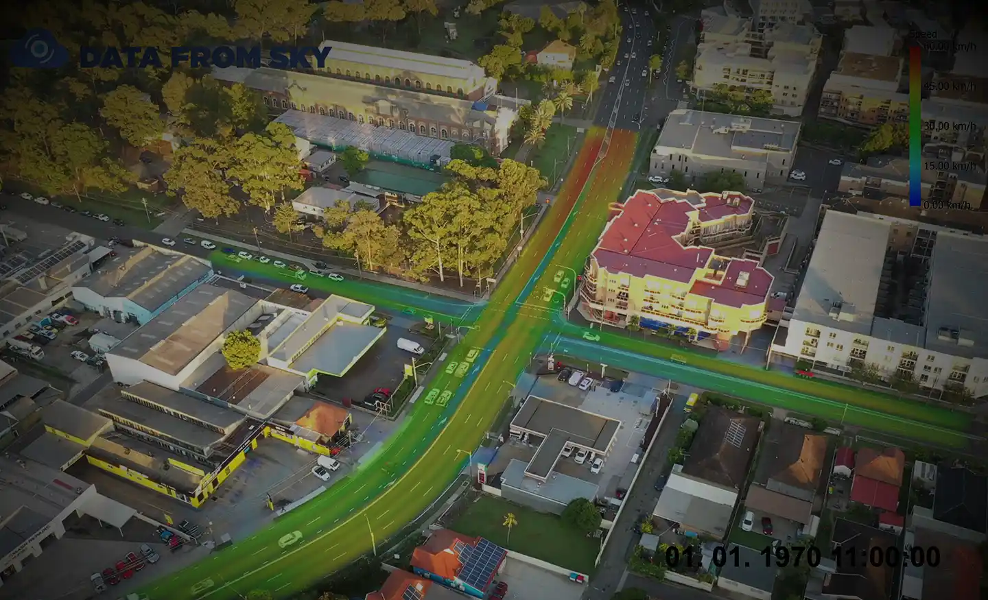
Comprehensive review of earlier traffic assessments to establish baseline conditions.

Our work included

  • High-level advice during early stages to guide Concept Plan development in relation to road network and pedestrian / cyclist connectivity.
  • Preparation of Green Travel Plan to support Green Star submissions.
  • Review and management of the VISSIM microsimulation modelling undertaken by the incumbent traffic engineer and preparation of a Traffic Impact Assessment to support submission to the Planning Assessment Commission.
  • Representation and advocacy for Frasers at numerous community consultation sessions, in dealing with Authorities (Council and TfNSW) and the PAC.
  • Further TIA studies in relation to sub-precinct Development Applications for submission to Liverpool City Council.
  • Detailed SIDRA Network modelling to confirm the suitability of the interim and staged delivery of the ultimate road network.
  • Sensitivity modelling regarding the impacts of alternative yield and land uses options to assist FPA respond to changing market demands.
  • Preparation of Traffic Management Plans to support proposed local road signage and community event closures of local roads to encourage a sense of Place throughout the community.
  • Construction stage services, including Construction Certificate Design Statement and Operational Traffic Management Plan for the Town Centre.

Similar Projects

Ason Group was engaged to undertake the capacity analysis and assess the operational performance of the current and proposed design in terms of Level of Service provided to pedestrian circulation on the block and adjacent streets in Sydney CBD. The Legion pedestrian model was developed to perform virtual experiments on

View Details

Pitt Street Modelling

Survey using Unmanned Aerial Vehicles (Drone) and TomTom GPS. Real-time traffic data and impact forecasts.

View Details

Victoria Road Corridor Analysis

The Mamre Road Precinct (MRP) forms part of the Western Sydney Employment Area (WSEA) and Aerotropolis was rezoned in June 2020 to permit industrial land uses across approximately 850 hectares of land and over 3.5 million square metres. Ason Group was engaged to work with key stakeholders including Transport for

View Details

Mamre Road Precinct – Road Network Assessment