Moorebank Intermodal Precint

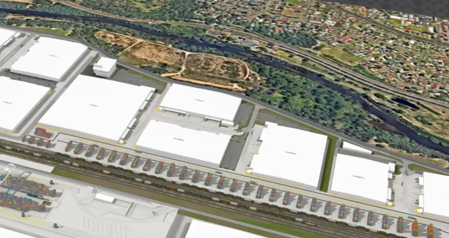
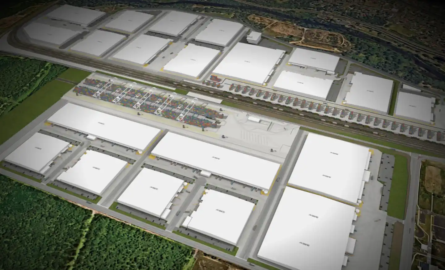
At 240 hectares, ESR’s Moorebank Intermodal Precinct is Australia’s largest intermodal facility. Conveniently located on Moorebank Avenue 1 kilometre south of the M5 Motorway interchange, the facility is ideally situated for the distribution of goods both regionally and nationally via the road and rail networks. Due to its favourable location the facility already counts Kmart, Woolworths & Mainfrieght amongst its tenants.

  • 850,000 m2 of industrial & warehousing GFA
  • 1.55 million TEUs of container freight throughput

Our work included

  • A complete due diligence review of the traffic engineering and transport planning that has informed current approvals.
  • Due diligence traffic analysis, including Aimsun micro-simulation modelling, for prospective tenants.
  • SIDRA modelling to test the staged and ultimate delivery of infrastructure requirements.
  • Construction & Operational Traffic Management planning, including site inspections, to ensure safety compliance.
  • Implementation of a vehicle monitoring system using video analytics to ensure compliance with DPHI conditions.

Similar Projects

Ason Group was originally commissioned in 2017 to undertake the development assessment of the Master Plan for 45-61 Waterloo Road Macquarie Park, providing for some 117,000m2 of commercial GFA.Subsequently we have also been commissioned to provide Transport Assessments for the first 3 buildings, including Building C (now known as “The

View Details

Waterloo Road

Ason Group has been engaged to undertake traffic modelling works to support the proposed upgrade of the Swan Hill/ Murray River Road bridge. The bridge provides a key crossing opportunity across the Murray River and services agricultural freight routes between NSW and Victoria. It also operates as a lift span

View Details

Swan Hill Bridge Upgrade Traffic Study

Ason Group was engaged by TfNSW to undertake multiple ITAP assessments including over 30 intersections and corridors across a range of locations in NSW. Ason Group proposed and successfully implemented the use of drone technology to record intersection operations and deliver a greater level of traffic movement insights not previously

View Details

Integrated Transport Action Plan (ITAP)